Category: Walks – Hiking – Horseback

  • 10 Magnificent Churches of Kartli

    10 Magnificent Churches of Kartli


    In this series of posts, I document an extraordinary trip to 10 churches in the Shida Kartli region. In this specific post, I share photos from that trip. For more detailed descriptions, see my post on Rkoni Monastery, or the incredible medieval “Tamar” bridge near to Rkoni.

    This trip is accessible by jeep tour only. To book your tour, contact us directly!


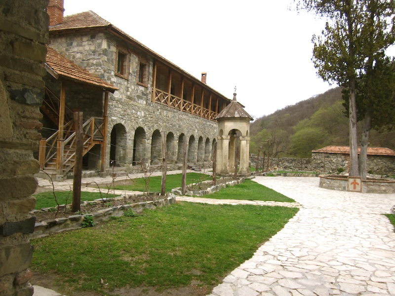
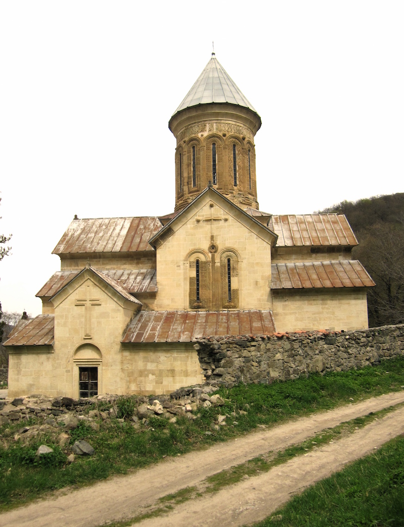
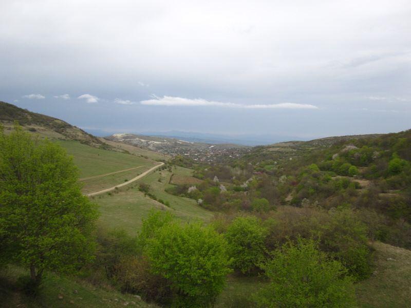
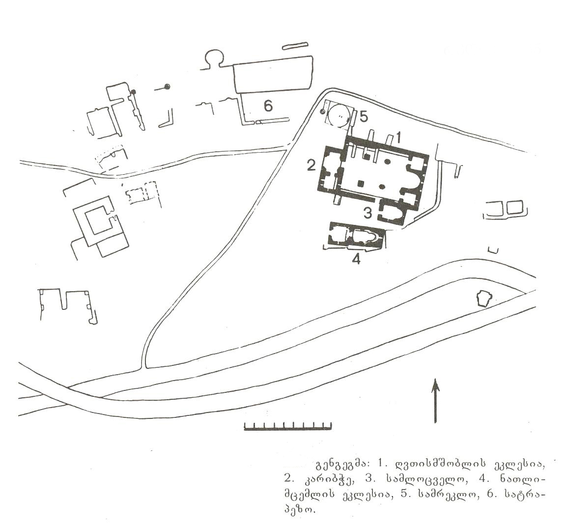
    The Kvatakhevi Monastery (12th c.), Kartli


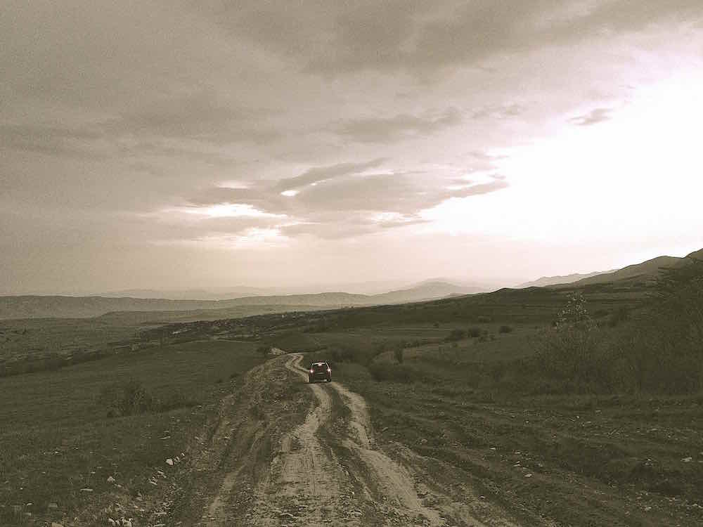
    The Kvatakhevi Monastery is at the top of a box canyon in the northern hills of the Trialeti mountain range. The dirt track leading to this historical site comes from the Mtskheta-Kaspi road along the Mtkvari river, near the village of Kavtiskhevi.

    The Monastery dates to the 12th century, and was an important center of Christian worship throughout the middle ages. Several existing manuscripts are known to have been copied in the scriptorium there.

    In the 19th century, much of the monasteries treasure was ‘borrowed’ and is now part of the Moscow State Historical Museum collection, a fate of many important historical artifacts in Georgia.

    Kvatakhevi is connected with the history of liturgical chant in the figure of Archimandrite Tarasi Aleksi-Meskhishvili, a 19th century abbot of the monastery. He was responsible for rebuilding the monastery, especially rebuilding the damaged dome and putting on a new roof. He was an expert chanter, and helped train Grigol Karbelashvili to chant in the mid-19th century. Grigol’s five sons would be the last generation of expert chanters in East Georgia.

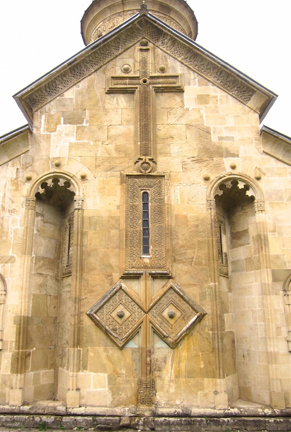
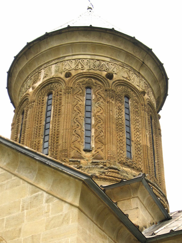
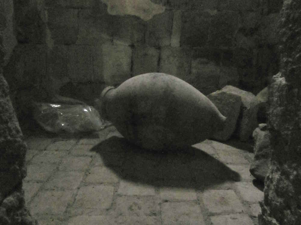
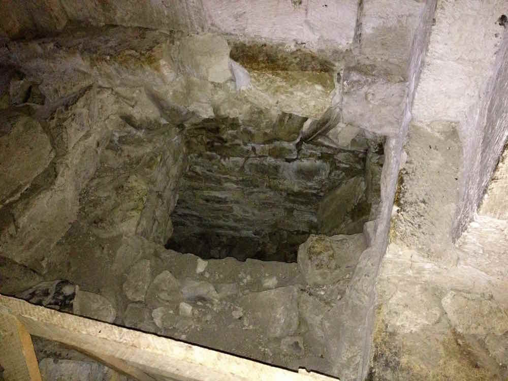
    More photos of Kvatakhevi Monastery:

    The Ertatsminda Cathedral (12th c.), Kartli


    Ertatsminda Cathedral, Kartli churches


    The Ertatsminda (One is Holy) Cathedral is located in the center of a small village with the same name.

    The cathedral is gigantic, well built, and very impressive for such a small village. It’s architectural form, a dome on top of a cross-form plan, is typical of the great cathedrals built in the “Golden Era” of Georgian prosperity (12th-13th centuries). It’s smooth sandstone blocks, ornate carving, and bold exterior presentation are emblematic of the projection of power during that period. Similar exemplars of this architectural period include the nearby Kvatakhevi, Pitareti, Tsughrughasheni, Betania, and Ikorta monastery churches.

    The church has an unusual dedication: that of St. Evstati of Mtskheta, a martyr saint executed in 550 AD by Persian Zoroastrian authorities. The story of this saint is told in a hagiographic narration written shortly after his death, representing some of earliest layers of Christian hagiography. Scholar Stephen Rapp and others have written about this important work.


    The Chachubeti Church (10th c.), Kartli

    Chachubeti church in Kartli, Georgia

    The Chachubeti church of the Mother of God is located on a bluff above the hamlet of Chachubeti (pop. 26 in 2002, maybe less now). The town is 29 kilometers from Kaspi, on the road to Rkoni.

    The church dates to the 10th century, though it was renovated in the 13th-14th centuries, according to the sign posted outside. The basilica measures 35×25 feet, and has three entrances. There are only a few fresco fragments remaining.

    The view from this church is stunning, if you have a chance to stop and take a look around.


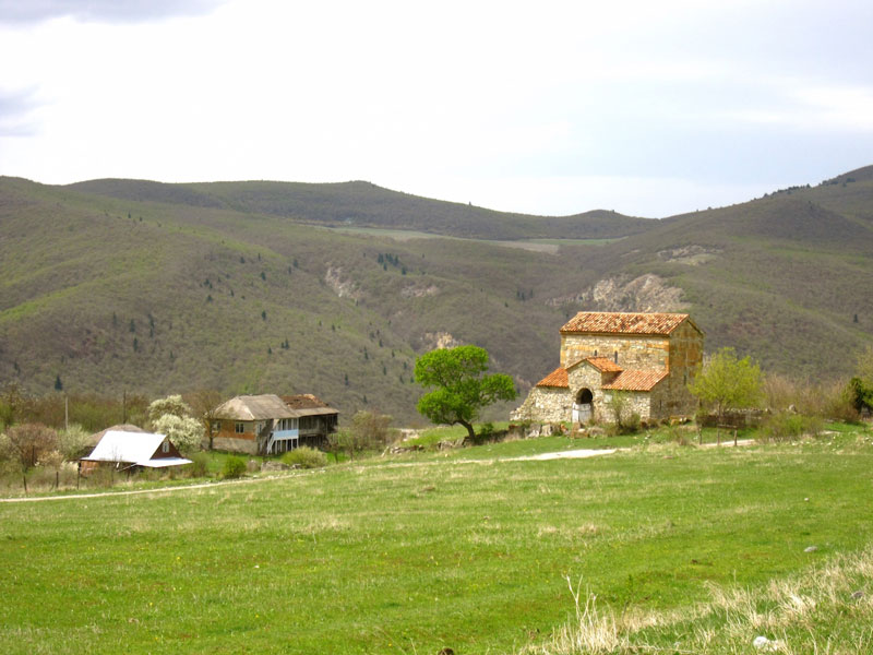
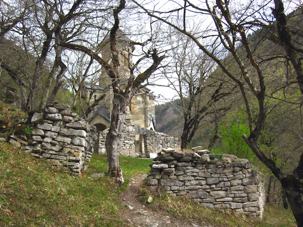
    The Maghalaant Church (12th c.), Kartli


    Maghalaant Church, Kartli churches


    The Maghalaant basilica dates from the 12th-13th centuries, a period of general prosperity and construction in East Georgia.

    In the 15th century, the Maghaladze clan from Imereti were given the lands near the entrance to the Kvatakhevi gorge. They fortified the church with exterior walls and a guardhouse, giving the church its current name. The family grew in importance in the late 17th century, and were awarded tavadi (duke) status in 1701 by King Erekle I of Kakheti.

    The bell-tower and defensive walls were further fortified in 1716 by one, Solomon Maghaladze, according to a placard, but have since fallen into near ruin.

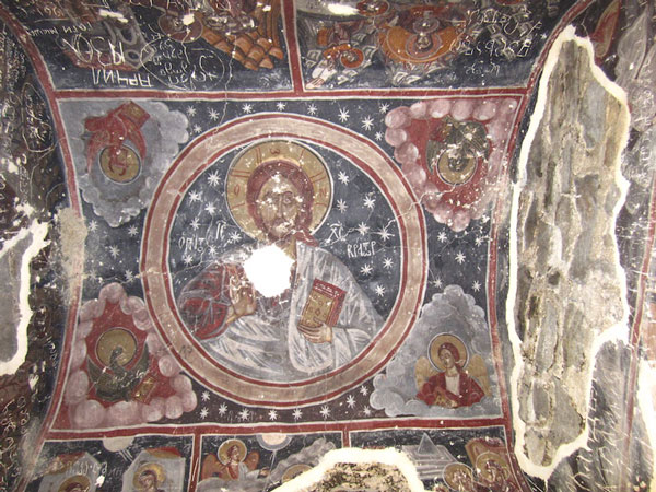
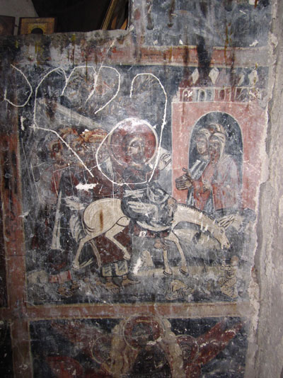
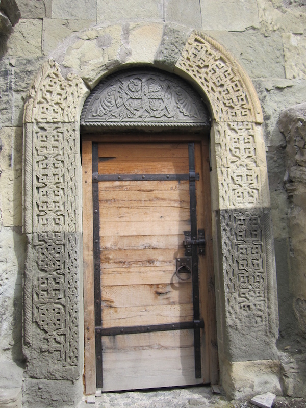
    Inside the church, incredibly detailed and creative frescoes are in very good condition, but are in severe need of cleaning and restoration work.

    More photos of the Maghalaant Church:

    The Ikvi Church (11th c.), Kartli


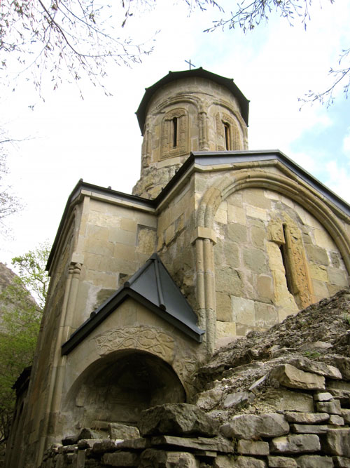
    The Ikvi church is one of the most picturesque small chapels in all of Georgia. It’s elegant dome, set on a tiny floorplan, sits alone in a forested gorge. In the past, the village of Ikvi existed somewhere nearby, but today there isn’t a trace of it left.

    It is also somewhat mysterious. No legends survive, no stories of attack, martyrdom, or divine healing surround this church. It’s almost as if the oral history of the church has been forgotten.

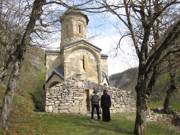
    At the beginning of the 20th century, the church was in bad disrepair. Records show that in 193901940 some restoration work on the walls was completed. More recently, a thorough restoration project has just completed. I was extremely impressed to see the quality of renovation (a rarity in construction projects in Georgia): new roofs, holes patched, a new door, and all done with taste and care. Furthermore, all trash and construction materials had been removed. Not a single sign exists to document the work either. One either notices it, or not!

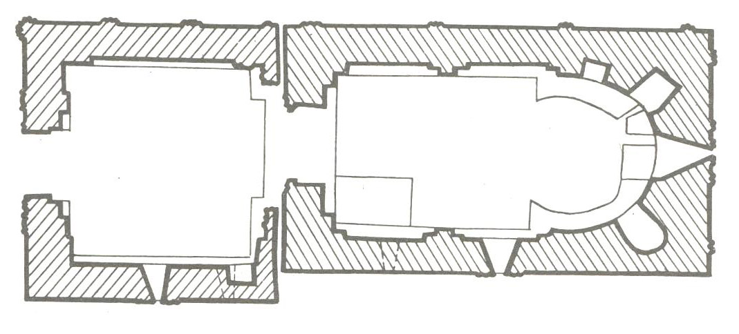
    Plans of the Ikvi Church:

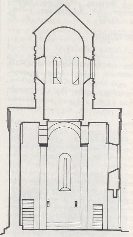
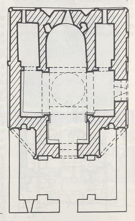
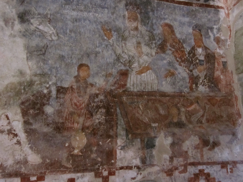
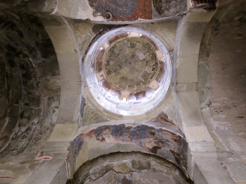
    But the church couldn’t have been that bad off, because an incredible number of frescoes survive! These look original to the 11th-12th century building, and are remarkably intact. For fresco aficionados, Ikvi church is a “must-visit.” I couldn’t believe the composition and detail. Moreover, despite the plan of the church being tiny (only 30×25 feet), it displays only the highest quality masonry, exterior ornamentation, architectural proportion, and interior wall painting.

    More photos of the Ikvi Church:

    The Rkoni Monastery Complex (7th-18th c.), Kartli

    The 7th basilica dedicated to the Dormition of the Theotokos, Rkoni Monastery, Kartli

    For the full description with videos and photos of the monastery complex, see our post on jeep tours to Rkoni Monastery.


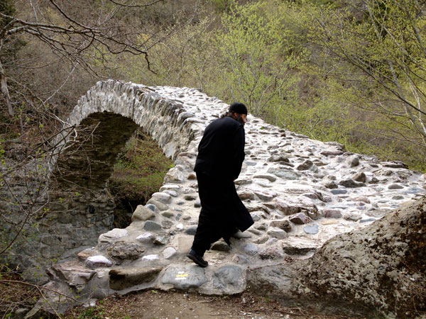
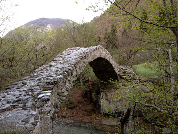
    The medieval “Tamar bridge” near Rkoni (12th c.), Kartli

    Tamar bridge, Rkoni region, Georgia

    A separate post describes how to find the medieval “Tamar bridge” near the Rkoni monastery. The bridge is also one of the architectural wonders of Georgia, and shouldn’t be missed!


    The St. Simeon Stylite tower church (12th-13th c.), Kartli


    St. Simeon Stylite Tower Church, near Rkoni Monastery


    See our post for the full description with videos and photos of the St. Simeon Stylite tower church and frescoes.


  • Jeep Tour to Rkoni Monastery

    Jeep Tour to Rkoni Monastery


    In this series of posts, I document an extraordinary trip to 10 churches in the Shida Kartli region. To see the full post on the Churches of Kartli, click here. In this specific post, I share photos and video of the incredible 7th century Rkoni Monastery, and the tower dedicated to St. Simeon Stylite on the ridge above the monastery.

    This trip is accessible by jeep tour only. To book your tour, contact us directly!

    The Rkoni Fortress

    To reach the monastery complex, one has to pass the imposing Rkoni fortress, once the summer home of Queen Tamar, and according to legend, the site of much treasure hoarding over the centuries.

    Rkoni Fortress

    The fortress is situated at the confluence of two branches of the Tedzami river deep in a gorge sloping down the northern flank of the Trialeti mountain range in central Georgia. To find it, we drove one hour West of Tbilisi to the nearest big town of Kaspi, then south up into the hills for another hour.

    Because there is no jeep access to the Rkoni monastery and medieval “Tamar bridge,” visitors park at the last village and walk under the Rkoni Fortress up river along a 2 kilometer foot path.

    A 17-second glimpse of the magical Rkoni forests in early spring!

    [kad_youtube url=”https://www.youtube.com/embed/LB2Jaio2mRo?rel=0?ecver=2″ maxwidth=”600″]


    But in the medieval period, the road clearly did not stop here. It continued up the gorge, past the impressive Rkoni Fortress ruin, and into the mountains.

    From the top of the gorge, travelers would have found themselves in the heart of the Trialeti mountain range, from where they could access roads to the Ateni gorge, the Dzamis gorge, or to climb to the highlands of Bakuriani and Tsalka. These routes connected the Mtkvari river valley with the entire southern kingdom of Samtskhe-Javakheti, an alternative to the treacherous and dangerous track along the Mtkvari river through the Borjomi Gorge to the West.

    Medieval "Tamar bridge" at Rkoni Monastery, Kartli

    A series of extremely well built arching stone bridges were strategically constructed up the gorge in order to allow for horse and cart traffic (take a look at my parallel post about “Tamar” bridges to see video of the stunning Rkoni medieval bridge).


    Approaching and entering the 7th century basilica of Rkoni!

    [kad_youtube url=”https://www.youtube.com/embed/t_FrvHqXQ6A?rel=0″ maxwidth=”600″]

    Inside the Dormition of the Theotokos basilica, Rkoni Monastery

    The Rkoni Monastery complex has many different buildings, some in half ruin. The basilica dedicated to the Virgin dates from the 7th century, and is in need of interior restoration (last received official preservation work in 1972).

    Other buildings in the complex, such as the church of St. John the Baptist and the bell tower, date to a later period of construction (13th-14th century). Still other buildings are ruins from as late as the 18th century, the sheer number of such ruins suggesting that a large community of monks lived here (see plan to the right).

    The basilica is normally locked to visitors because there are fears that the frescoes could be damaged, or worse, that someone could be injured by falling ceiling pieces. Also, the monastery is very remote, and does not typically have anyone there to attend to the actions of visitors.

    According to my friend and guide, monk Zakari, in the summer months, monks from the Kvatakhevi Monastery walk to Rkoni on Fridays (a 5 hour hike), stay overnight, and return on Saturdays. During their visit, they clean up trash, open the church, answer questions, discourage amorous behavior on the monastery grounds, and chase away any would-be graffiti artists. 🙂

    It’s not a perfect situation, but until there is more regular and systematic staff on site, it works.

    With monk Zakari as our leader, our small group was able to gain entrance to the monastery via a secret key. Inside, we were amazed with what we found.

    The church is basilica form, about the same size and floor plan as the Anchiskhati basilica in Tbilisi, or the Kvelatsminda basilica in Gurjaani. At least, that is what I was reminded of.

    The space is clean, except for a few materials that look like they’re waiting for the preservation experts: boards for scaffolding, a few ropes, etc. In one side chapel, there is an intact qvevri – the clay vessel used for storing wine. The floor is tiled with Georgian square clay tiles.

    The uphill side of the Rkoni Monastery complex
    [kad_youtube url=”https://www.youtube.com/embed/pwIODEajK2w?rel=0″ maxwidth=”600″]


    There are frescoes in the two side chapels, dating probably from the 12th-13th century period, though I couldn’t be sure. There are also intact frescoes on the West wall, but the sunlight coming through the single window in the West wall made it impossible for us to see those photographs, or indeed, to photograph them.

    The exterior stone work suggests multiple reconstructions of the church. The ornamental stonework at the crest of the roof is characteristic only of churches from the 6th-8th centuries.


    Viewing the Simeon Stylite tower at Rkoni!

    [kad_youtube url=”https://www.youtube.com/embed/tnB495My1XM?rel=0″ maxwidth=”600″]


    13th c. Church of St. Simeon the Stylite, near the Rkoni Monastery

    After crossing the “Tamar” bridge at Rkoni, we scrambled up a steep hillside to a medieval tower, built into the hillside far above the monastery. The three-story tower is surrounded by forest.

    A recently patched up wall around a narrow yard displays evidence of recent attention. Indeed, older photos on the internet reveal that the roof and first floor used to have gaping holes. Now, gratefully, the tower church has a new roof and patched up exterior walls. No one is complaining that the old wooden door to the yard, which gives so much character to the place, still hangs by one hinge in a permanently half open position (see video).

    Inside the tower, we climbed steps to the top level where we found original frescoes on the walls, dating back to the 13th-14th century period. Through narrow slit windows, spectacular views up and down the valley suggest that the tower church doubled as a sentry post.

    On the river side, the views are spectacular: straight below and across the river, a plan view of the Rkoni Monastery spread out before us with each rooftop clearly defined against the green meadow around the monastery.

    Down valley, the sun glinted off of the white limestone of the imposing ruin of the Rkoni Fortress, and up valley, the view commands several switchbacks of the tumultuous Tedzami River as it winds upwards into the forested upper canyon. Turks, even Tamerlane, are said to have come from the plateaus above, while enemies might easily come up from from the broad valleys of the Mtkvari river as well.


    Returning home at Dusk

    As we returned to our car at dusk, we snapped this photo with the last full-time inhabitant of the local Rkoni village. Maybe in the future, more people will return to live in this village. There is talk of a paved road, increased economic activity from tourism, and renewed interest from local people. Indeed, a new hotel is being built in the village.


  • Finding the medieval “Tamar bridge” near Rkoni Monastery

    Finding the medieval “Tamar bridge” near Rkoni Monastery

    In this series of posts, I document an extraordinary trip to 10 churches in the Shida Kartli region. To see the full post on the Churches of Kartli, click here. In this specific post, I share photos and video of the incredible medieval stone bridge, a so-called “Tamar bridge”, named for the famous 12th century monarch of Georgia under whose reign these bridges were presumably built.

    This trip is accessible by jeep tour only. To book your tour, contact us directly!


    Our Trip

    After driving several hours over winding dirt tracks through the hills above Kaspi and Ertatsminda, we left the car at the small village of Rkoni. From here, passable roads stop. Visitors carry on by foot.

    But in the distant past, the road continued. A series of extremely well built bridges were strategically constructed up the gorge in order to allow for horse and cart traffic to travel between the plains of the Mtkvari river valley and the highland plateaus and summer grazing lands to the south. These date from the late 12th century during the reign of Queen Tamar (1160-1213)!

    My friend Fr. Zakari was kind enough to be my guide on this trip. He was born and raised in Kaspi, and spent his childhood summers in Rkoni village with his extended family. He and his brother, who also joined our excursion, spent their childhood years exploring the forests, monasteries, and fortresses all around this region. Fr. Zakari also asked permission of the bishop to get into the locked 7th century basilica of the Virgin at Rkoni Monastery.

    If you don’t have a guide like I did, here is how to find the bridge! First find the Rkoni Monastery. From there, walk upriver about 200-300 meters on the only trail that goes that direction.

    Catching sight of the bridge is amazing. I invite you to watch this short video clip I shot while there.


    Medieval Tamar bridge over the Tedzami River near the Rkoni Monastery

    [kad_youtube url=”https://www.youtube.com/embed/SA-Hg2reb7Y?rel=0″ maxwidth=”600″]


    Arriving at this medieval “Tamar bridge”, for me, produced an amazing feeling. It was a feeling of surprise, joy, amazement, wonder, awe, and intense engineering curiosity all mixed together at once!

    Sketch of the Tamar bridge at Rkoni
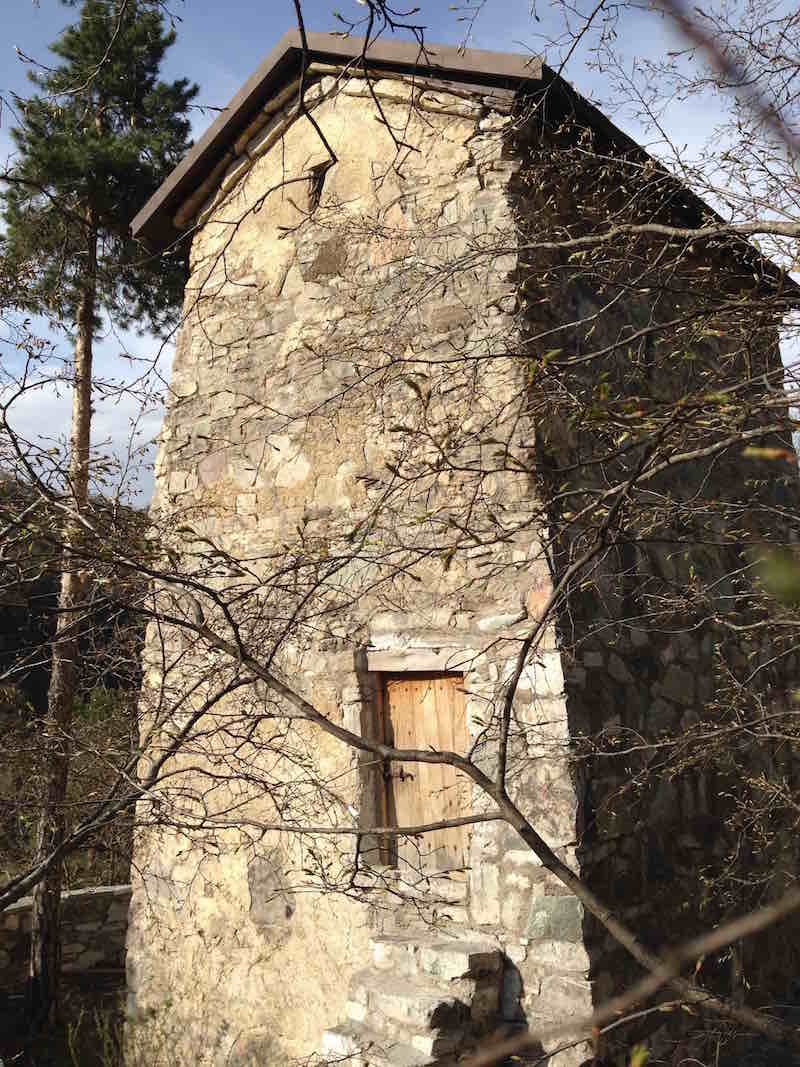
The location is so rural, so out of the way, the technology so simple yet graceful. One can’t help but marvel at the ingenuity of the construction, and at the same time the improbability of its survival for the last 900 years.

    The high arching stone with no supports… it is as graceful as the European flying buttresses on Gothic cathedrals. But while those are in cities, on major buildings, here we are in the most backwoods rural forest one can find in Georgia, in what is today the virtual wilderness of the Trialeti Mountain range, looking at an architectural gem of a bridge.

    Rkoni medieval bridge in Georgia, seen on John Graham Tours.

    The bridge is constructed from local stone, embedded in a very thick and strong whitish mortar that must be some medieval cement combination that included lime and possibly egg (eggs were definitely used in mortars and plasters used for church construction.

    The bridge is most impressive when viewed from below. The best view point is across the river from the Rkoni Monastery, a few steps upriver. From there, this is the view:

    After playing around at the bridge, maybe having a picnic in the broad meadow on the other side, I recommend the 15 minute scramble up the hill to the tower church of St. Simeon Stylite!


    Aerial footage of Tamar bridge at Rkoni and surrounding sites

    [kad_youtube url=”https://www.youtube.com/embed/t_TqTi6uteQ?rel=0″ maxwidth=”600″]


    Enjoy this professional produced video, featuring aerial views of the Tedzami river, Rkoni monastery, and local Drisi castle. The soundtrack is not bad either!

    For those interested in hiking possibilities, there are now marked trails through the Trialeti Mountain range. Two of these trails converge at the Rkoni village. Do internet searches for trails on the Rkoni-Kldekari track that goes into the Algeti National Forest. Access from the south is from Rkoni. Access from the north is from Manglisi.


  • Singing for the Saints at Betania Monastery

    Sometimes in Georgia, it’s hard to get any work done. The culture demands a more nuanced, flexible approach to life than just adhering to 8-hour work days. Here’s one example that came up. Late Sunday night, a friend called and said,

    “Did you know that tomorrow is the feast day of the Betania saints? There will be a liturgy in the morning, and they’re asking for chanters. Can you come?”

    Of course I can come! I hadn’t been back in years. How could one turn down such an opportunity?

    Monday, February 21st. Four of us chanters met at 8am to begin our journey. After winding around for an hour in the hills, we finally skidded and slid down the treacherous ice patches passing for a road to the monastery (the car would never make it out that day, we had to get other rides home). The sun gleamed off the snow, and the bright yellow sandstone of the church. I hadn’t forgotten any details, but the beauty of the place overwhelmed me once again.

    In 2005 and 2006 I sang the Easter all-night-vigil service there, and my memories of my own spiritual journey at the time are still strong. I had memorized several chants there in all three voice parts, including aghdgomisa dghe ars, the first heirmos of Pascha, a chant I still sing often.

    As we still had a half hour until the service, we stomped around outside in the snow, trying to stay warm, throwing a few snowballs, and reading the captions on the graves of the saints buried just outside the East end of the monastery. During the early decades of the Soviet period, Ioane Maisuradze (†1957) and Giorgi-Ioane Mkheidze (†1960) lived at the monastery as monks, continued the work of rebuilding the failing cupola, and became revered spiritual men in their later years. To read about their lives, see this link. Today we honor them with our chants, and ask for their intercession.

    Frescoes of Queen Tamar (12th century)
    Frescoes of Queen Tamar (12th century)

    Betania Monastery is located about 8 miles up a forested ravine outside of Tbilisi, but the old footpath has long since over grown from lack of use. The monastery is situated such that enemies couldn’t see it from any of the surrounding hills, tucked near to the bottom of the steep ravine, so it was spared many of the ravages of Tbilisi over the centuries. It contains one of the rare original frescoes of the 11th-12th century monarch, Queen Tamar.

    The bell started ringing. Making our way inside the dim lit church, one couldn’t help but notice the two large wooden sarcophagi in the middle of the sanctuary space (see video below). A beam of light from the south apse clerestory windows shone down across them. The relics of the two saints were covered with embroidered white shrouds, flowers draped on all sides.

    Betania Monastery Plan, Prince Grigory Gagarin (1847)
    Betania Monastery Plan, Prince Grigory Gagarin (1847)

    We chanted the service, our bones numb from the chill penetrating our feet from the unheated flagstones. During breaks in the 4-hour liturgy, we filed outside to stamp our feet and praise the sun for warming our frozen bodies. Outside it was probably 30 degrees Fahrenheit, inside probably 20. At the end of liturgy, we venerated the relics, then filed outside for a paraklesis, a small addendum service, which we sang outside each wall of the church (see videos above).

    * * * * * * * * *

    To get to Betania, rent a taxi driver as the road is impossible to find on one’s own. A former road through Tskneti is under repair. The only road leads from Freedom Square up to Kojori, around towards Manglisi, above Kiketi, and down the Betania road. The Betania road needs 4×4 capability, otherwise it is a one hour walk from the Kiketi road above. Do not attempt to drive the road in icy or muddy conditions.

    UPDATE: As of January, 2020, the road through Tskneti is now re-opened to traffic. This is again the quickest and easiest way to get to Betania Monastery from Tbilisi.

  • Gergeti Sameba Monastery

    Gergeti Sameba Monastery

    The monastery of Gergeti Sameba in the Kazbegi highlands is one of the most iconic places one can visit in the whole South Caucasus.

    It is one of the most visited sites, most photographed sites, and most beloved sites of Georgians and tourists alike. Once one arrives, it’s not difficult to understand why: the 13th stone church stands atop a cliff some 1500 feet above the village of Gergeti, with the majestic 15,500 conical peak of Mount Kazbegi rising directly behind it.

    Every year hundreds of people climb to the top of Mount Kazbegi, a trip of some 4-5 days that requires 24 hours of acclimatization at a weather station at 12,000 feet altitude. But hundreds of thousands of people climb to Gergeti Sameba monastery. They go to give prayers, they go to breathe fresh air, they go to imagine life hundreds of years ago… and many go with no reason at all. It is simply the pull of the mountains. The pull to climb higher, go further, see beautiful landscapes, and feel what it means to be alive.


  • Martvili Canyon Tours

    The Martvili Canyon is a natural wonder in the Samegrelo region of Georgia, near the town of Martvili. Also called the Gachedili Canyon, it is about a 45 minute drive from the city of Kutaisi in West Georgia. In 2016, the Georgian government spent more than $500,000 on rebuilding the infrastructure around the canyon in order to make this growing tourist destination safer. The site had been virtually forgotten except by locals until the early 2000s, when more and more tourists started posting photos and videos on the internet.

    The incredible natural beauty of the secluded coves and azure-green water of the stream as it flows through the hidden canyon appealed to adventurers streaming into the Caucasus from Europe. In recent years, the site became unsafe as daredevils jumped from waterfalls, went swimming in high water, or went spelunking or river scuba-diving without proper equipment. Injuries and even deaths prompted the government to crack down with new regulations placed under the aegis of the Agency of Protected Areas (APA).

    The government’s attempts to streamline access to the site (through an electronic ticketing system) will increase safe access for tourists, but also decrease the hidden and secretive nature of the canyon – the hidden gem of Martvili.

    A footpath with bridges over, in, and around the short canyon will be a welcome addition for all visitors, however.

    Small streams running through the limestone near the town of Martvili have carved a series of spectacular caves and canyons. Some are accessible by raft, others have boardwalks built inside. Experience the natural wonders of Georgia!

    Prices are 17 gel/adult entrance ticket, plus 15 gel/adult to take a raft ride up the river canyon for 15 minutes.


  • Black Sea Coast (from the Botanical Garden)

    Black Sea Coast (from the Botanical Garden)

    The Black Sea coastline from the heights of the Batumi Botanical Gardens stretches more miles to the north towards the port of Poti, and south towards the port of Batumi. Greek, Roman, Byzantine, Ottoman, and of course Georgian soldiers have used these heights to scour the horizons for incoming ships for centuries, as evidenced by the nearby Roman-Greek fortresses of St. Peter at Tsikhisjiri and Apsaros at Gonio.

    Black Sea coast

               Nowadays, the Batumi Botanical Gardens inhabit the hilltop folds. Founded in the 1880s by Nikolayevich Krasnov, the history of the Gardens are very interesting. The trees and plants imported from around the world over the last century grow incredibly well, some better than their native environments!

               On a recent walk through the gardens, a local pointed at a particular tree and said, “do you see that?” We wondered what she was pointing out, and asked her to explain. “Half way up that palm tree, there’s a pine tree growing!” We looked closer and one by one, we finally saw it: a single pine branch, not less than 15 feet long, was growing out of some of the shag bark of the old palm tree. A bird must have brought the seed, we marveled, or maybe some crazy botanist grafted it there, speculated another.

                Further down the trail, we found a large tree fallen across a small ravine. It was such a large trunk, 20 people could walk across the ravine as if across a bridge, all at the same time. Even more amazing, a dozen smaller trees were growing straight up out of the fallen trunk, offering a series of hand holds for those venturing out on the trunk.